01
Chart-synced routes
Read the whole day at a glance.
Distance and time views, route metrics, grades, timing, and multi-day details. Hover the chart; follow the exact same point on the map.
 Better PeakbaggerTools for your next summit
Free & open source Browser extension
Your familiar Peakbagger, with better tools. Turn activities into ascent drafts, explore routes in 3D, and give your trip reports room to breathe.
No extra accountNo telemetryYou control Save
The extension
Your summit log, upgraded
Turn activities you own into evidence-backed ascent drafts. Read a track at a glance. Find the reports worth reading. Write like a human instead of a markup parser.
The extension handles the repetitive work, then stops before the decision that matters: Save.
From track to summit record
Open an activity you own on Garmin Connect or Strava. Better Peakbagger finds likely summit encounters, shows the evidence, and prepares only the drafts you choose.
A toolbar click grants temporary access to the one Garmin or Strava activity already open in your browser.
Strong and Probable labels summarize route proximity, elevation, summit shape, and track quality.
Selected summits open as prefilled Peakbagger drafts. Correct anything you want; the final save stays manual.
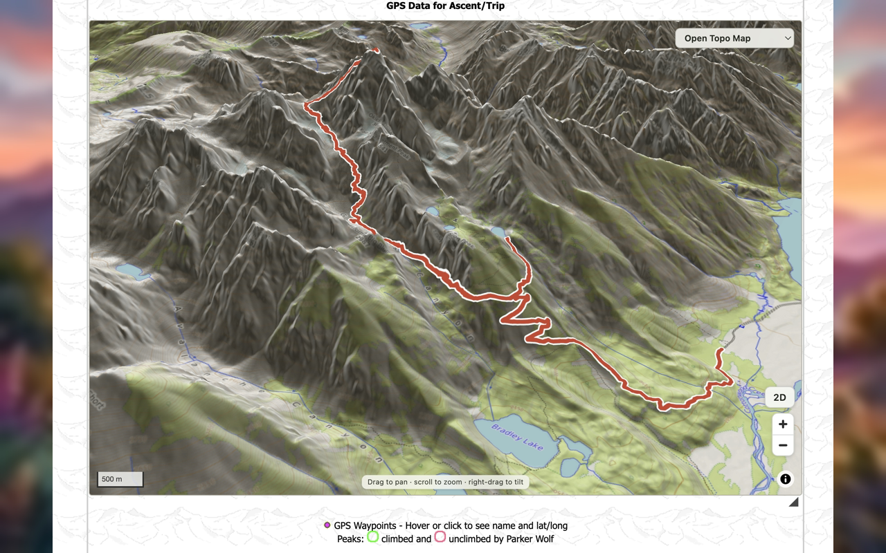
Open 3D terrain
The map should feel like the mountain
Turn Peakbagger’s GPX maps into true-scale 3D terrain. Keep the basemap you know, drape it over open elevation data, and watch the route rise off the page.
How the 3D map worksMaps you already use. Compatible CalTopo, ArcGIS, OpenTopoMap, and other layers can be draped over the terrain.
Open elevation data. Powered by Mapterhorn’s free, global elevation tiles.
Opt in, always. No 3D tile request happens until you enable the feature.
Everyday tools
Chart-synced routes
Distance and time views, route metrics, grades, timing, and multi-day details. Hover the chart; follow the exact same point on the map.
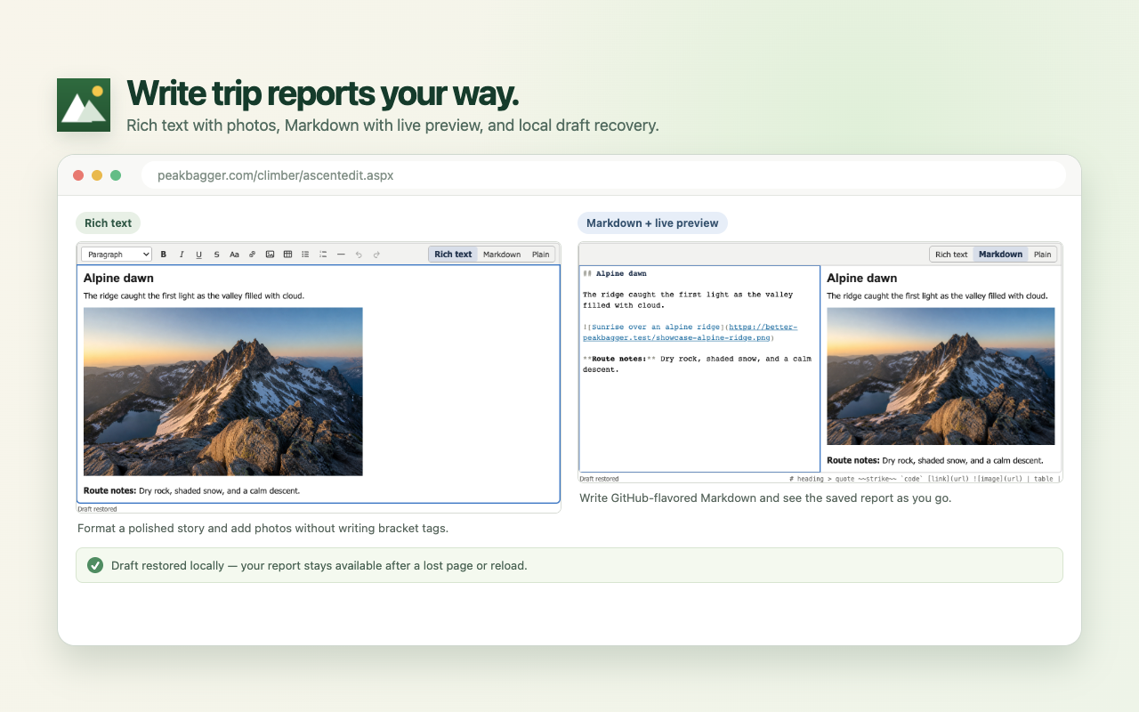
Trip reports
Switch between rich text, GitHub-flavored Markdown with live preview, or Peakbagger’s untouched native textarea. Rich and Markdown drafts recover locally.
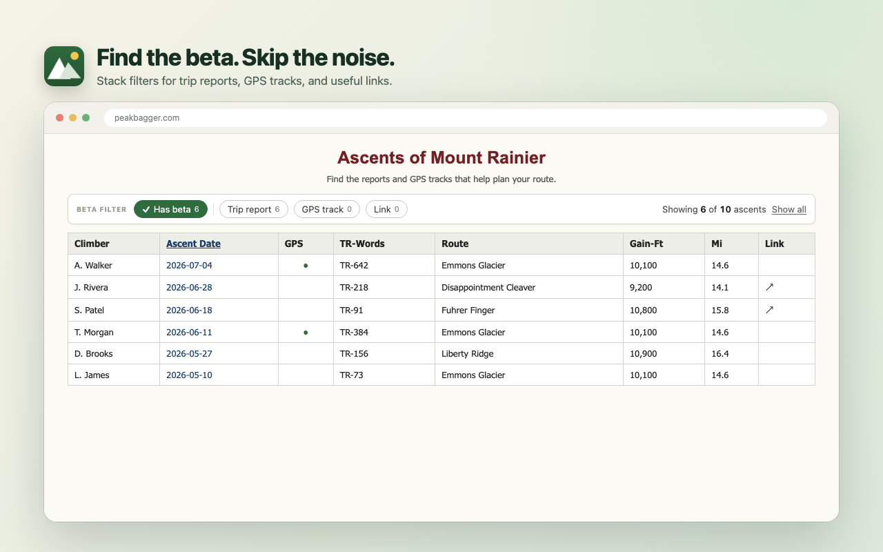
Useful beta, faster
Stack report, GPS, link, and favorite-climber filters. Get live counts and sortable columns without another page load.
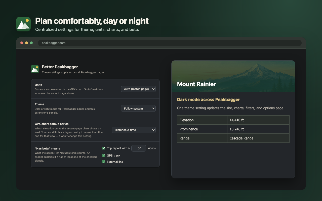
Dark mode + settings
Follow the system or stay light or dark. Tune units, chart defaults, route colors, map size, editor mode, 3D cache, and what “has beta” means to you.
GitHub backup
Back up reports as real Markdown, form data as JSON, and Peakbagger’s saved track to a private GitHub repository you control.
⌄ mt-rainier-2026-07-12
├ trip-report.md
├ ascent.json
└ track.gpx
Summit conditions
Jump from a peak directly to Windy, Copernicus satellite imagery, and—where available—snow depth or fire and smoke maps.
Privacy by design
Local by default. Optional by choice.
Raw Garmin or Strava GPX is processed on the activity page and is never stored or sent to the extension developer. Optional features stay off until you choose them.
Read the complete privacy contract“Do the repetitive work.
Stop before Save.”
Summit matching is evidence, not certainty—and an ascent log is your record. Strong matches are selected by default. Probable matches remain opt-in. You review both.
Common questions
Better Peakbagger is an independent passion project, not an official Peakbagger extension.
Garmin and Strava do not offer a practical free, unattended integration for a small independent extension. Better Peakbagger instead works through the provider page you already opened and signed in to, with temporary access to that one activity.
No. You must be signed in, the activity must belong to your account, and the page must provide unambiguous ownership signals. The extension fails closed when it cannot verify them.
Upload it on Peakbagger’s Add Ascent form. A Process button reads it on-page, finds summits along the route, fills useful fields, and prepares a privacy-reduced track for GPS Preview.
The 3D view requests map and elevation tiles only after you explicitly enable it. The feature is rendered in your browser and is covered in detail by the project’s public privacy contract.
Yes. Better Peakbagger is licensed AGPL-3.0-or-later. The source, architecture notes, issue tracker, and discussion board are all public on GitHub.
The next summit is enough work
Free. Open source. Available for Chrome, Edge, Brave, and Firefox.